I'm always very flattered when a group reaches out to me looking to work together on a mapping project. I admit, I was quite ignorant with regards to all that Quadra Island had to offer, so it was quite an enjoyable learning experience. Intrigued by the number and variety of trails, not to mention all of the other recreation to be found on the island, I had to visit. It did not disappoint. I brought tons of gear, but not enough time. I can't wait to return!
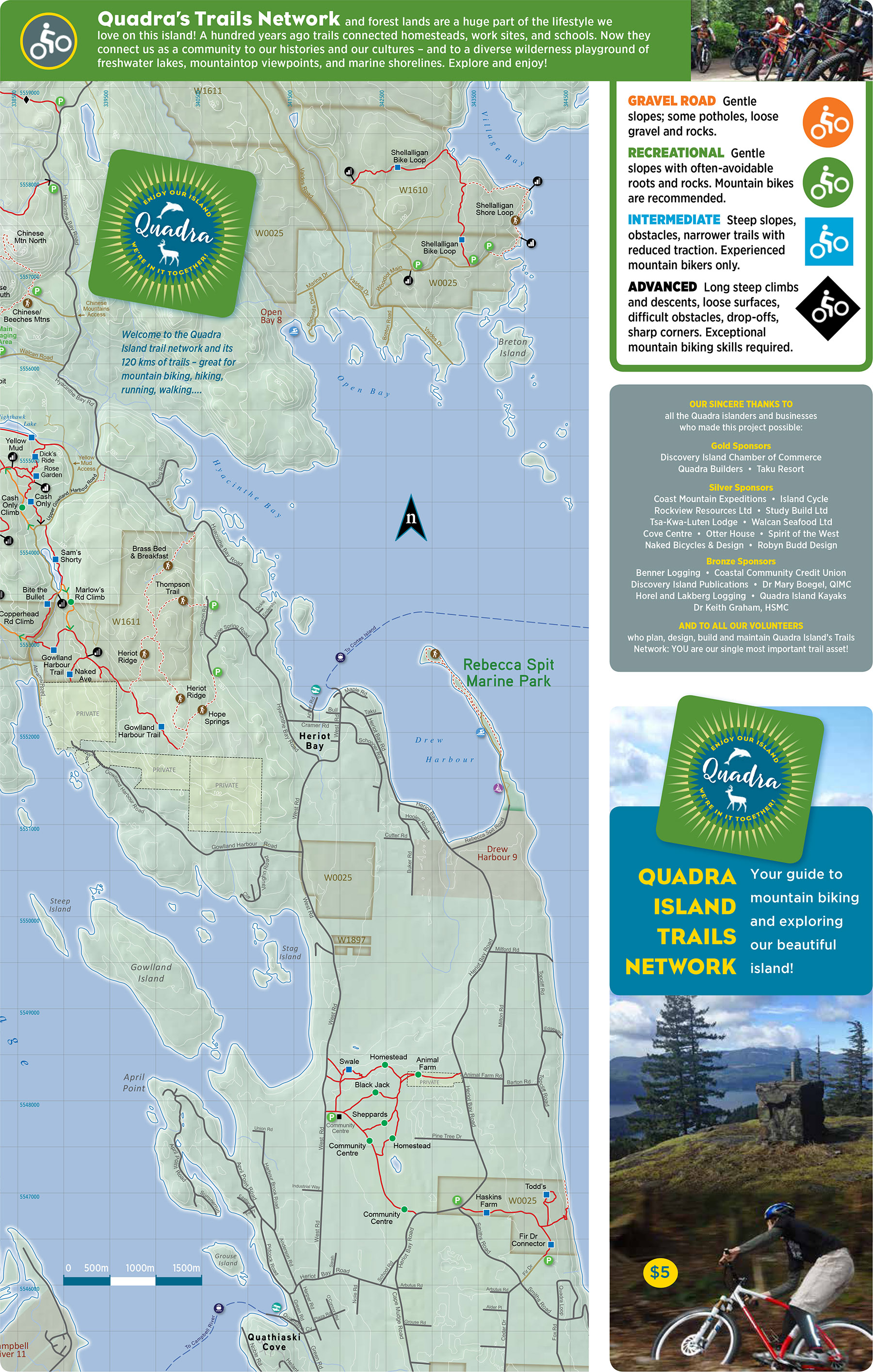
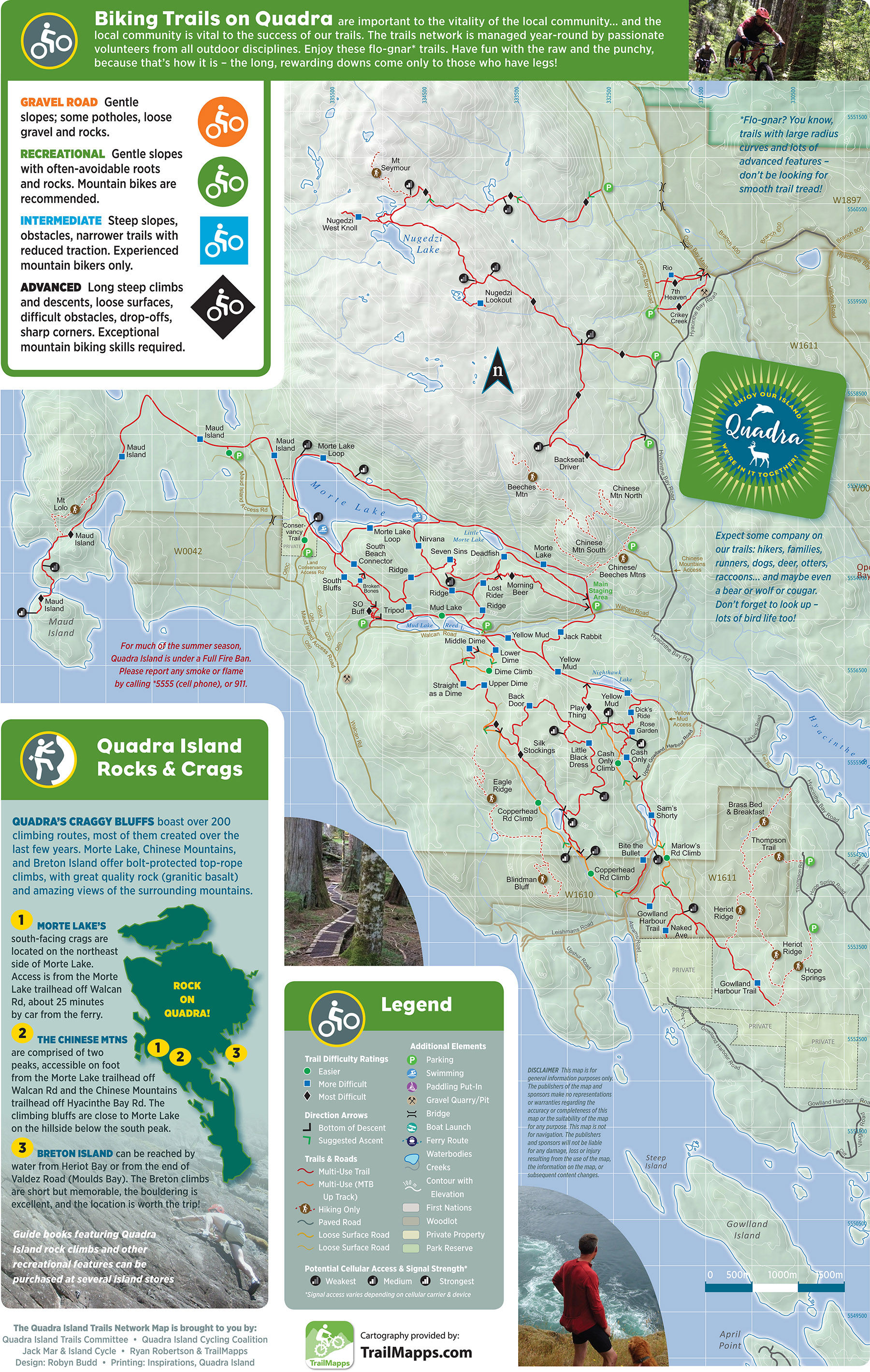
A couple of notable features on this map are the 500m UTM grid and the very important cell signal locations with potential strengths incorporated into the design. As the spots on the map suggest, cell signal is, um... spotty.
Below: Front side of the retail map. |
 |
Below: Backside of the retail map. |
 |
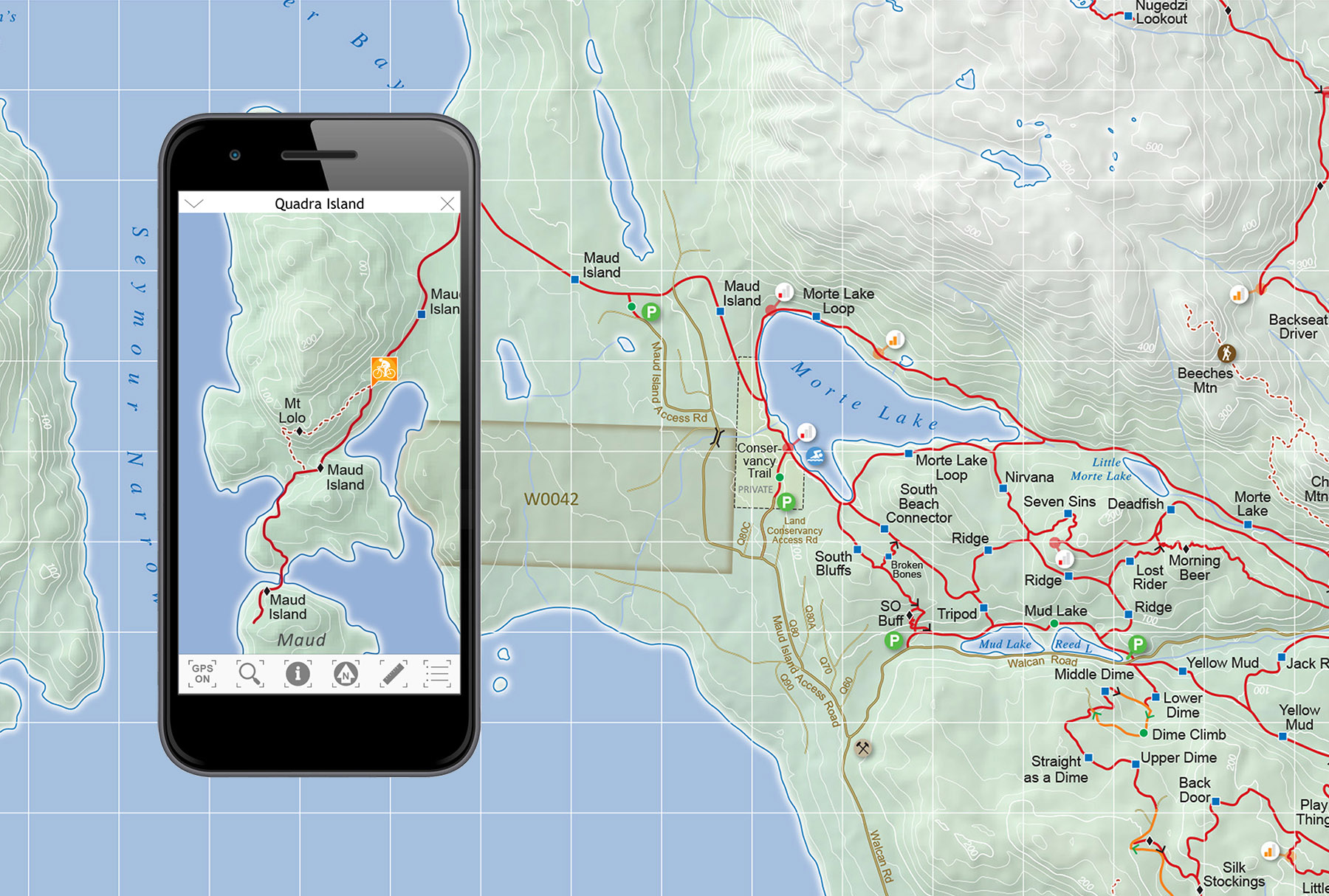
Below: I really hoped this project would lead to another TrailMapps app. I had a beta of the app running on my iPhone which turned out to be very handy; Quadra is not the easiest network of trails to navigate without a guide. |
 |
|