Leading up to a century ride on the Sunshine Coast and having driven highway 101 previously, I knew that portions of the route would be potentially harrowing given the long sections of road that have no shoulder to speak of. I remember studying the satellite imagery provided by Google Maps in an effort to mentally prepare myself for which sections would be the worst.
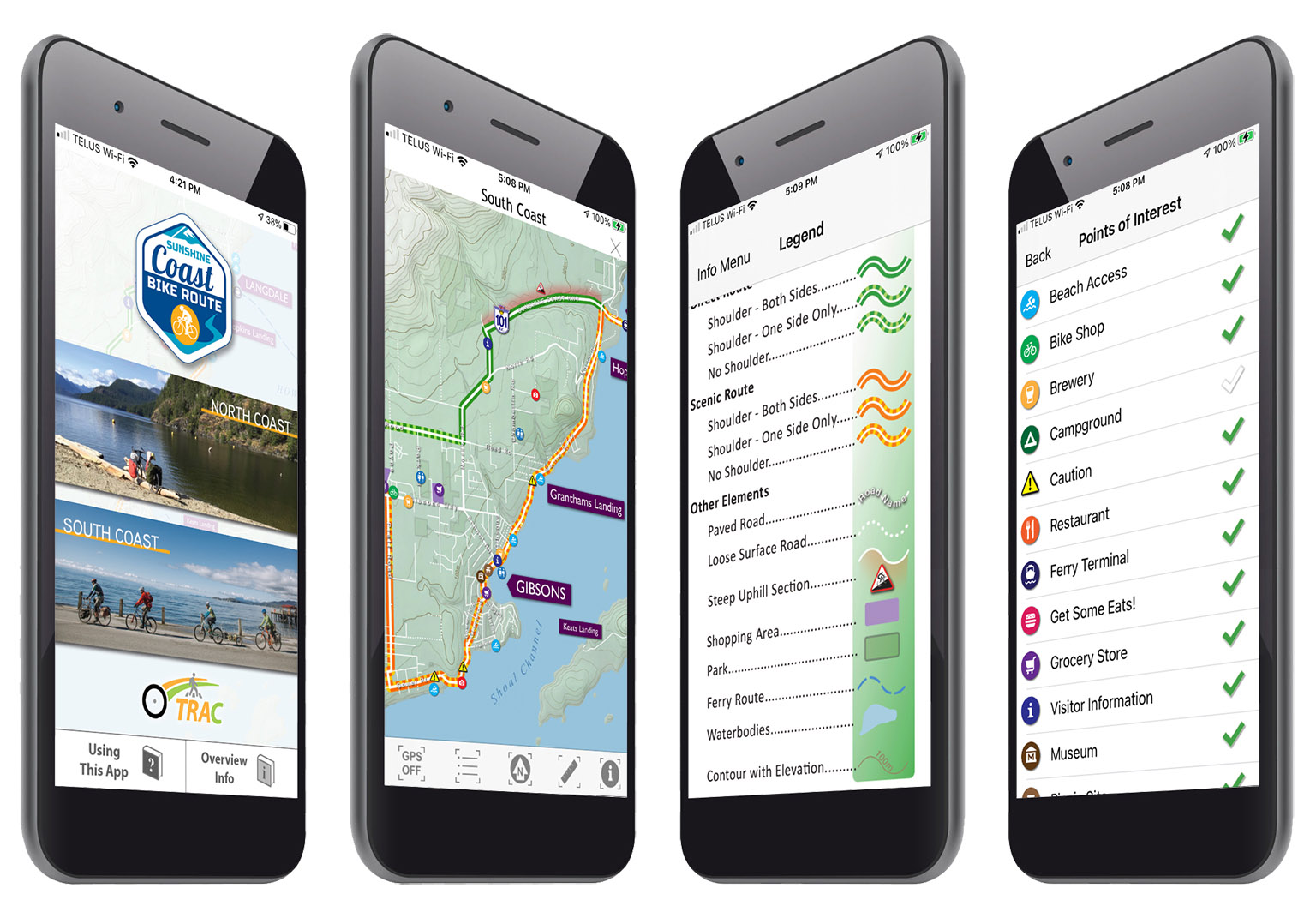
The ride was amazing and I have to say, being prepared for when the riding would require some caution was very beneficial. Therefor, I was elated when the Transportation Choices - Sunshine Coast group asked me to help put together an app for them. They collected all the data one would need in order to make informed decisions about how they wanted to enjoy the Sunshine Coast Bike Route. The map clearly shows where shoulders exist and where they don't. They had even mapped out all of the sections of steep climbing! |
 |
|
Another feature that is unique to this app, is the user's ability to toggle specific points of interest on and off. Want to grab some beers and go for a swim? Turn everything else off and focus on your goal! |
|
The Sunshine Coast Bike Route app is free to download for both iOS and Android. |
|